Garmin Navionics Vision+ NVSA004L -Mexico, the Caribbean to Brazil - Inland Coastal Marine Charts [010-C1285-00]
Navionics Vision+™ NVSA004L - Mexico, the Caribbean to Brazil - Inland & Coastal Marine Charts
It's A Whole New Look On Your Chartplotter
Featuring vibrant colors, a streamlined interface, and combined coastal/inland content with a popular Navionics® style color palette, Garmin Navionics+ cartography makes it easy to plot your course with the world’s No. 1 name in marine mapping1.
Features:
- Navigate with our best offshore and inland lake coverage for your Garmin chartplotter.
- See it your way. Customize your view with various chart layers and overlay combinations.
- With your included one-year subscription, access daily updates via the ActiveCaptain® smart-device app.
- Auto Guidance+™ technology2 lets you navigate with suggested dock-to-dock routings.
- Select up to 10 color-shaded target depth ranges to scope out the best fishing spots.
- Save money by renewing your subscription — and continue accessing daily updates plus new content downloads.
- Access detail-rich mapping of coastal features, lakes, rivers, and more. Integrated Garmin and Navionics® content offer coverage for boaters worldwide.
- Charts are constantly being enhanced with new and amended content — as many as 5,000 updates are made every day. Your one-year subscription includes access to daily chart updates via the ActiveCaptain app.
- Combining the best of Garmin and Navionics automatic routing features, built-in Auto Guidance+ technology2 gives you a suggested dock-to-dock path to follow through channels, inlets, marina entrances, and more.
- High-resolution depth range shading lets you select up to 10 color-shaded options and view your designated target depths at a glance.
- For improved fishing and navigation, up to 1' contours provide a clear depiction of bottom structure for improved fishing charts and enhanced detail in swamps, canals, harbors, marinas and more.
- To give a clear picture of shallow waters to avoid, this feature allows for shading at a user-defined depth.
- NOAA raster cartography3 is available for some U.S. waters as a free downloadable feature via the ActiveCaptain app to provide paper chart-like views on your plotter.
- Community-sourced content provides useful POIs, such as marinas, anchorages, hazards, businesses and more. Get recommendations from boaters with firsthand experience of the local environment.
- This downloadable shading feature4 combines color and shadow to give you an easy-to-interpret, clearer view of the bottom structure than contour lines alone.
- The downloadable sonar imagery feature4 reveals bottom hardness clearly and in contrasting colors, highlighting both subtle and dramatic transition areas on select U.S. lakes.
- Downloadable high-resolution satellite imagery4 provides superior situational awareness.
- Crystal-clear aerial and surface photos of ports, marinas, bridges, docks, boat ramps, dams, and navigational landmarks provide a better sense of your surroundings above the waterline.
- Side-scan images capture submerged features such as fallen timber, fish attractors, wrecks, potential hazards, and more on select U.S. lakes.
- This underwater perspective shows a 3D representation of the bottom and contours as seen from below the waterline. Interface with sonar data for a customized view.
- This view provides a 3D representation of the surrounding area both above and below the waterline.
- Adjust your maps to the lake’s current water levels to see if spots are accessible or too shallow to explore.
1 Based on 2021 reported sales
2 Auto Guidance+ is for planning purposes only and does not replace safe navigation operations
3 Raster cartography cannot be viewed on echoMAP™ CHIRP and ECHOMAP™ Plus combos but can be viewed on mobile devices via the ActiveCaptain mobile app
4 Subscription required; a one-year subscription, which is included with the purchase of Navionics Vision+ mapping solution, lets you access daily chart updates and download additional content or premium features included with your cartography product

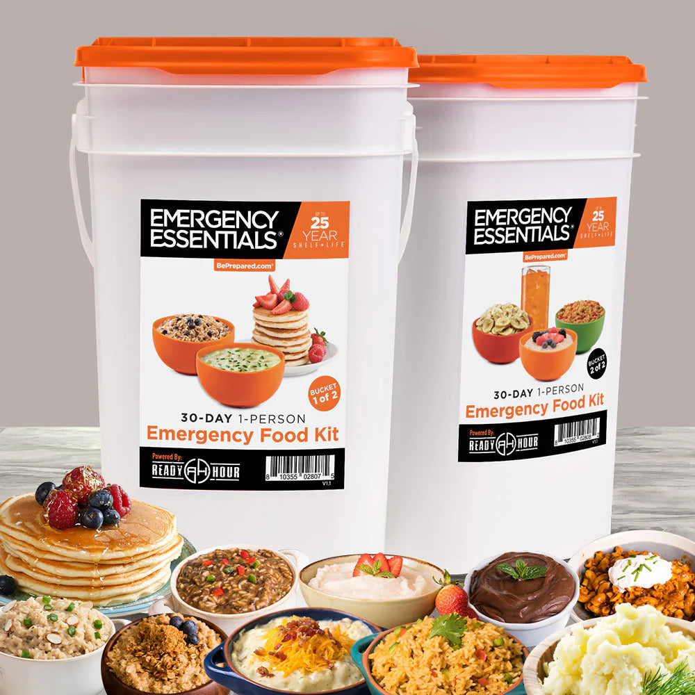
Our Bestselling Gear


What Our Customers Are Saying
"As a mom, nothing matters more than protecting my family. Entropy Survival’s emergency kits gave me peace of mind knowing we’re prepared for anything."
"I bought the pet emergency kit for my dog and was amazed at the quality! Everything is thoughtfully packed to keep pets safe and healthy during any disaster."

"The Safe Trail Kit is a must-have for hikers! Lightweight, affordable, and packed with high-quality essentials — it kept me safe and prepared deep into the backcountry."
"Entropy Survival has the best selection of quality survival gear I’ve found. Whether prepping for off-grid living or emergencies, their depth and reliability are second to none."
GOT QUESTIONS? WE'VE GOT ANSWERS!
Yes, you can track your order via our interactive chat or via email. To see your order status, please provide your order details.
We currently only ship to confirmed addresses in the United States. We offer free shipping on all orders $99 or more.
If you purchased an item through our website and need to return it, you can request a refund within 30 days of the shipping date. To qualify for a full refund, the product must be returned in "new" condition – unused, unaltered, unworn, and containing all original components (e.g., all parts of The Safe House Kit).
HAVE QUESTIONS OR NEED HELP CHOOSING THE RIGHT SURVIVAL GEAR? GET IN TOUCH WITH US TODAY – WE'RE HERE TO HELP!